|
|
 Map Drawing
The support for digital maps in Digital Cemetery is a great help in the daily use of the software.
Although it is not a mandatory request, the presence of the map is highly suggested to improve the
the usage of the software.
The creation of map is a two-step process: in the first one you import the DXF file made
with AutoCAD or equivalent freeware programs like DraftSight
or QCad,
with the second step you set the attributes to the burials (sector, row, number, etc).
There is a procedure for the test and the import of the map in DXF format.
The second step can be avoided if all the attributes of the plots are set directly in dedicated layers.
Creating Map
Technical specifications
The map should be drawn in AutoCAD or equivalent program and saved to DXF format, according to the specifications that include:
- 5 different mandatory layers with the following names: trim, perimeter, buildings, tombs, texts
- You can add other optional graphic details in four dedicated layers named sections,
series, details and Misc
- The trim layer must contain a rectangle that bounds all over the map
- The perimeter cemetery must include the boundaries of the cemetery and sections
- The buildings level must contain the outlines of buildings present in the cemetery, as the chapels, churches, blocks of niches or ossuaries seen from above
- The tombs must be done using closed polylines and represents selectable objects on the map
- The texts must contain descriptions that should appear on the maps activating the corresponding level and must be included as a Text entity
(text on a single line), for example Sector A, Ossuary B, etc.
- The sections layer is an optional layer useful to border main groups or areas of burial plots
- The series layer is an optional layer useful to border small groups or zones of burial plots
- The details and Misc layers are optional elements that can be considered
useful in the use of map (for example to sign the entrance of the cemetery, water points, the compass sign showing the north, etc)
Must not be used splines, arcs, circles.
Front vision blocks of niches and/or ossuaries can be designed:
- outside the perimeter of the cemetery adding references to its original position through comments in the Text layer
- directly to the location of the block, if there is space
The DXF file can contain additional layers that will be not directly shown in the final map but they are used to set different attributes of the burial plot, during the importing operations,
the layers are called _cemeteries, _numbers, _sections and _series.
The kind of layers contain textual elements, like the cemetery names, numbers, sections and series of the burial plot and they must be placed into the polyline of the corresponding layer.
- The _cemeteries layer contains the name of the cemeteries in the map, each string must be placed into the corresponding rectangle of the perimeter layer
- The _numbers layer contains the numbers of the burial plots, each string must be placed into the corresponding rectangle of the tombs layer
- The _sections layer contains the sections of the burial plots, each string must be placed into the corresponding rectangle of the sections layer
- The _series layer contains the series of the burial plots, each string must be placed into the corresponding rectangle of the series layer
All the strings present in this additional layers are saved into the main texts layer at the end of the import procedure.
Even if not expressly indicated where possible it is recommended that you always use polylines, to obtain a usable map faster.
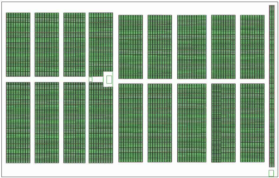
In the Docs folder created during the installation there is an example of DXF file with all the layers described in this guide.
This is a sample of a map of three cemeteries (Holy Family Catholic Church in Caledonia, Michigan) after
the import in the software; you can download the source file from the following link:
Zipped DXF file (226 KB)
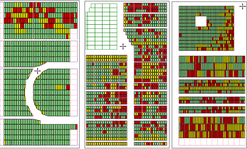
Another sample of a map, with only one cemetery (Rexburg, Idaho), you can download the source file from the following link:
Zipped DXF file (838 KB)
|
|